Physical Address
304 North Cardinal St.
Dorchester Center, MA 02124
Physical Address
304 North Cardinal St.
Dorchester Center, MA 02124

A hidden world beneath Antarctica has just been exposed in unprecedented detail.
Scientists have discovered 332 massive submarine canyons lurking beneath the frozen continent’s waters—five times more than anyone knew existed. Some of these underwater valleys plunge over 4,000 meters into the abyss, deeper than the Grand Canyon is tall.
This isn’t just another geographic discovery. These canyons are actively reshaping how warm ocean water reaches Antarctica’s vulnerable ice shelves from below, potentially accelerating the timeline for catastrophic sea level rise worldwide.
Researchers from the University of Barcelona and University College Cork just published what may be the most important Antarctic mapping study in decades.
Using high-resolution bathymetric data from over 40 international expeditions, they’ve created the first standardized map of Antarctica’s submarine canyon networks.
According to the study published in Marine Geology, these aren’t just any underwater valleys.
“Some of the submarine canyons we analyzed reach depths of over 4,000 meters,” explained Dr. David Amblàs from the University of Barcelona. These canyons match or exceed some of Earth’s largest known submarine features.
The sheer scale is staggering.
Until now, scientists believed Antarctica had maybe 60-70 submarine canyons. This new mapping reveals 332 distinct canyon networks—fundamentally altering our understanding of the continent’s underwater landscape.
The discovery reveals something even more troubling about Antarctica’s stability.
East Antarctica’s canyons are complex and branching, with wide U-shaped profiles that suggest millions of years of gradual formation. They start with multiple canyon heads near the continental shelf edge, then converge into massive main channels descending into the deep ocean.
West Antarctica tells a different story entirely.
Here, the canyons are shorter, steeper, and cut into sharp V-shapes—signs of more recent and volatile glacial activity. This aligns perfectly with what climate scientists fear most: West Antarctica is already unstable and melting faster than predicted.
Dr. Riccardo Arosio from University College Cork noted this stark difference hadn’t been documented before in large-scale seafloor mapping, though sedimentary records had hinted at it.
The implications are sobering. If West Antarctica’s younger, more dynamic canyon system continues channeling warm water beneath its ice shelves, we could see accelerated melting beyond current climate models’ worst-case scenarios.
These canyons aren’t passive features—they’re active highways for ocean water that directly threaten ice stability.
Acting as massive underwater conduits, they channel dense, salty water from Antarctica’s continental shelf into the deeper Southern Ocean. This process drives global thermohaline circulation, the planet’s primary ocean current system that regulates temperatures worldwide.
But here’s where it gets alarming.
The same canyons also work in reverse, funneling warm Circumpolar Deep Water from the deep ocean directly under Antarctica’s floating ice shelves. This warm water is literally melting the ice from below—a process that’s largely invisible from the surface but devastating in its efficiency.
Dr. Alan Condron from Woods Hole Oceanographic Institution explained that this canyon-driven water exchange isn’t a minor side process. It’s central to how heat reaches the ice and how fresh meltwater escapes into the ocean.
The newly discovered extent of these canyon networks means warm water has far more pathways to reach vulnerable ice than anyone realized.
Current climate models used by the Intergovernmental Panel on Climate Change have a fatal flaw.
They’ve been treating Antarctica’s seafloor as relatively smooth and featureless. The discovery of 332 complex canyon systems completely invalidates this assumption.
These models have been missing crucial physical processes including current channeling, vertical mixing, and deep-water ventilation—all essential for accurately predicting ice loss and sea level rise.
Without accounting for how these canyons accelerate warm water delivery to ice shelves, every projection about future sea level rise could be dangerously optimistic.
The research team emphasized that incorporating these canyon networks into climate simulations will likely show faster ice loss timelines than previously calculated.
Some canyons could determine whether melting from inland glaciers reaches the ocean quickly or stays locked in place—a distinction with massive consequences for coastal cities worldwide.
The scale of what’s been hiding beneath Antarctica is almost incomprehensible.
Many of these canyons remained undetected until now because of the extreme challenges of collecting sonar data beneath floating ice shelves. The new study used Version 2 of the International Bathymetric Chart of the Southern Ocean (IBCSO v2), offering 500 meters per pixel resolution compared to the previous 1-2 kilometers.
This resolution upgrade revealed intricate details previously invisible to science.
In East Antarctica, the canyon systems often begin with multiple heads that branch like tree roots before converging into single massive channels. Some extend for hundreds of kilometers, carving valleys that dwarf anything on dry land.
The western canyons, while shorter, are dramatically steeper—indicating they formed through more violent geological processes tied to the region’s unstable ice dynamics.
Each canyon system tells a story about Antarctica’s glacial history stretching back millions of years.
The timing of this discovery couldn’t be more critical.
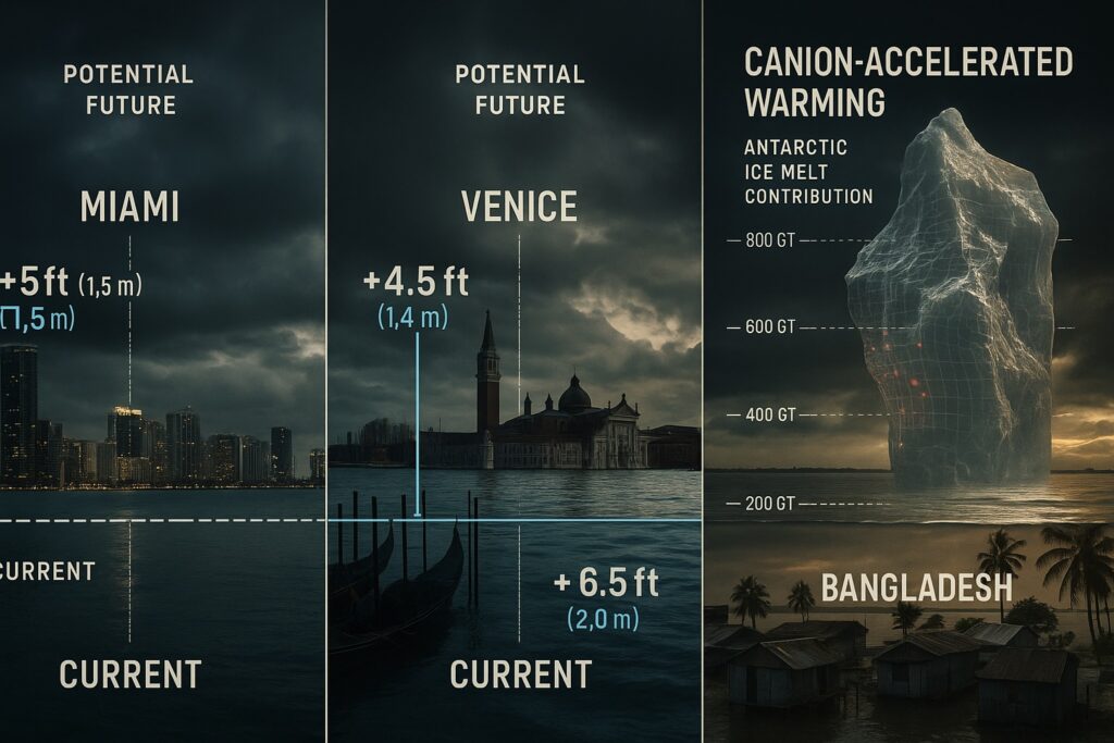
With 332 pathways for warm water to attack Antarctica’s ice shelves from below, the continent’s contribution to sea level rise could accelerate dramatically. The canyons in the vulnerable Amundsen Sea region are particularly concerning, as this area is already experiencing rapid ice loss.
Current projections suggest several feet of sea level rise by 2100.
But those projections didn’t account for how efficiently these canyon networks deliver warm water to ice shelf bases. The actual rise could be significantly higher and happen much faster than coastal communities are preparing for.
The research team warns that these canyons create feedback loops—as ice shelves weaken and break apart, they allow even more warm water to penetrate further inland, accelerating the melting process.
This discovery fundamentally changes the risk calculus for every coastal city on Earth.
Scientists are now racing to gather more high-resolution data from Antarctica’s still-unmapped regions.
The team used a semi-automated method for identifying and analyzing canyons, developing a GIS software script that calculates canyon-specific morphometric parameters. This technological breakthrough made it possible to map these features at a continental scale for the first time.
But this is just the beginning.
Researchers say we need to combine detailed mapping with in-situ observations and remote sensing to fully understand these canyon systems. They’re calling for increased international collaboration to deploy autonomous underwater vehicles and advanced sonar systems to Antarctica’s most remote regions.
Every new canyon discovered could reveal another pathway for accelerated ice loss.
The urgency is real—understanding these submarine features isn’t just about satisfying scientific curiosity. It’s about predicting how quickly our planet’s coastlines will be reshaped.
Beyond their climate implications, these canyons are rewriting Antarctica’s geological story.
The stark differences between East and West Antarctic canyon systems support theories that the East Antarctic Ice Sheet formed much earlier than its western counterpart. This was previously suggested by sedimentary records but never confirmed through large-scale seafloor geomorphology.
The canyons formed through turbidity currents—underwater avalanches of sediment that carved valleys over millions of years.
In Antarctica, the combination of steep submarine slopes and massive volumes of glacial sediment amplified these currents’ effects, creating some of Earth’s largest submarine features.
These geological scars tell us that Antarctica hasn’t always been the frozen continent we know today.
The canyon networks preserve evidence of dramatic climate shifts, ice sheet advances and retreats, and ocean current changes spanning tens of millions of years.
As researchers work to map Antarctica’s remaining unexplored seafloor, one thing is crystal clear.
We’ve been dramatically underestimating the complexity of processes driving ice loss. These 332 canyon networks aren’t just geographic features—they’re active participants in Earth’s climate system.
The discovery shows that Antarctica’s influence on global ocean circulation is far more intricate than previously understood.
With only 27% of Earth’s seafloor mapped in high resolution, scientists estimate thousands more submarine canyons remain undiscovered worldwide. But none are more consequential than those surrounding Antarctica.
Dr. Amblàs and Dr. Arosio conclude that continued high-resolution mapping combined with observational data and improved climate models is essential for accurately projecting climate change impacts.
The canyons have been there all along, silently channeling warm water toward the ice.
Now that we know they exist, the question becomes: can we update our climate models and coastal preparations fast enough to account for what they’re telling us about our future?
The answer will determine the fate of every coastal community on the planet.